England covers over 50,000 square miles (130 439 square kilometres) and is the largest of the countries comprising the island of Britain, covering about two-thirds of the island. No place in England is more than 75 miles (120 km) from the sea.
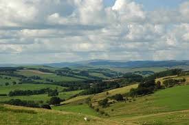
The landscape is determined mainly by the different types of rock underlying it. In the south, chalk has produced the gently rolling hills of the Downs, while hard granite is the basis for the mountains of the north and the high moorlands of Dartmoor and Exmoor in the south-west.
Much of the land in England is flat (low lying) - less than 1000m above sea level, forming meadowlands and pastures and less than 10 percent of the area is covered by woodlands.
Farmers raise animals or grow crops in the fields.
Weather and climate - what’s the difference?
Upland areas are generally confined to northern England: the exceptions are the upland moors of Dartmoor and Exmoor in the south-west.
he landscape of England is more rugged in the north and the west. The highest elevations are in Cumbria
The Southwest
is a long peninsular with bleak moorlands and rocky outcrop. The wide expanse of Salisbury Plain .The southeast corner, from Dover to Eastbourne, has dramatic chalk cliffs bordering the English channel.

Rivers
occupies most of the central part of southern England.
In the Southeast, a horseshoe-shaped ring of chalk downs surrounds the formerly wooded area of the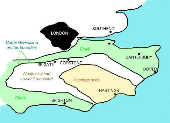
The English Channel runs along England's southern border, and the North Sea forms England's eastern border. Wales and the Irish Sea border England to the West. Scotland runs along England's northwestern borders
 .
.
Seven Sisters (chalk cliffs)
The landscape is determined mainly by the different types of rock underlying it. In the south, chalk has produced the gently rolling hills of the Downs, while hard granite is the basis for the mountains of the north and the high moorlands of Dartmoor and Exmoor in the south-west.
Much of the land in England is flat (low lying) - less than 1000m above sea level, forming meadowlands and pastures and less than 10 percent of the area is covered by woodlands.
Farmers raise animals or grow crops in the fields.
Weather and climate - what’s the difference?
It is important to understand the difference between weather and climate. Both refer to what happens in the atmosphere.
- Weather is the condition of the atmosphere over a short period of time - what happens day to day
- Climate is the average expected weather over the seasons for a region - the long term pattern
To put it another way:
climate is what you expect; weather is what you get!
Upland areas are generally confined to northern England: the exceptions are the upland moors of Dartmoor and Exmoor in the south-west.
he landscape of England is more rugged in the north and the west. The highest elevations are in Cumbria

The Southwest
is a long peninsular with bleak moorlands and rocky outcrop. The wide expanse of Salisbury Plain .The southeast corner, from Dover to Eastbourne, has dramatic chalk cliffs bordering the English channel.
Rivers
occupies most of the central part of southern England.
In the Southeast, a horseshoe-shaped ring of chalk downs surrounds the formerly wooded area of the
England's best known river is, of course, the Thames which flows through London. It is also the longest, at 346km, in England.The River Severn  is the longest in total, but its source is in the mountains of Wales, and the parts which run through England are shorter than the Thames.
is the longest in total, but its source is in the mountains of Wales, and the parts which run through England are shorter than the Thames.
Coastline
England has a long coastline of 3,200 km. In the south and west, the coastline can be rocky, with steep cliffs. The east coast is often flat and low lying, with beaches and mud flats.
The Borders of England.
The English Channel runs along England's southern border, and the North Sea forms England's eastern border. Wales and the Irish Sea border England to the West. Scotland runs along England's northwestern borders
The Cheviot Hills are a range of low mountains forming a border between England and Scotland. They extend 35 miles ( 56 km) is a north-eastern to south-western direction. The hills are part of the Northumberland National Park.
The Peak District lies in the southern part of the Pennines. It contains England's first national park, which was established in 1951 . The Peak District covers and area of about 555 sq miles (1,438 sq km). The northern region of the Peak District is covered in moors and oddly shaped hills. The central and southern regions have rolling hills and green valleys
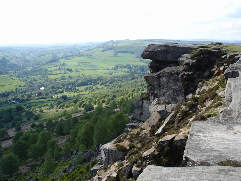 .
.
national park, which was established in 1951 . The Peak District covers and area of about 555 sq miles (1,438 sq km). The northern region of the Peak District is covered in moors and oddly shaped hills. The central and southern regions have rolling hills and green valleys.
The North Yorkshire Dales lie east of the Pennines. This national park stretches across 500 square miles (1,295 square kilometers), touching the North Sea. In the south is the Yorkshire moors consisting of low hills covered with coarse marsh grasses and low evergreen shrubs of heather.
The wide expanse of Salisbury Plain occupies most of the central part of southern England. It covers an area of approximately 300 square miles ( 775 sq km) and is drained to the south by the River Avon. Sailsbury plain is a barren chalk plateau without trees and much of it is used as a pasture for sheep.
Many people travel to see Stonehenge, a prehistoric monument located on Salisbury Plain.
The Downs are a series of rolling chalk hills found in southern England.
The Downs are a series of rolling chalk hills found in southern England.
The Seven Sisters are chalk cliffs, part of the coastline of the south-eastern tip of England.
Seven Sisters (chalk cliffs)
Dartmoor moorland area is famous for the wild Dartmoor ponies that live there.
While England is a relatively flat country, it certainly is not devoid of impressive mountains and many rolling hill plains.
These create a gorgeous topography and a natural allure to the jade-coloured countryside of this land.
Britain is certainly blessed with an enviable pedigree of mountains. Whether it’s the iconic Ben Nevis or majestic Snowdon, England’s Scafell Pike or the rolling Pennines, there’s plenty to behold – and to climb.
Ben Nevis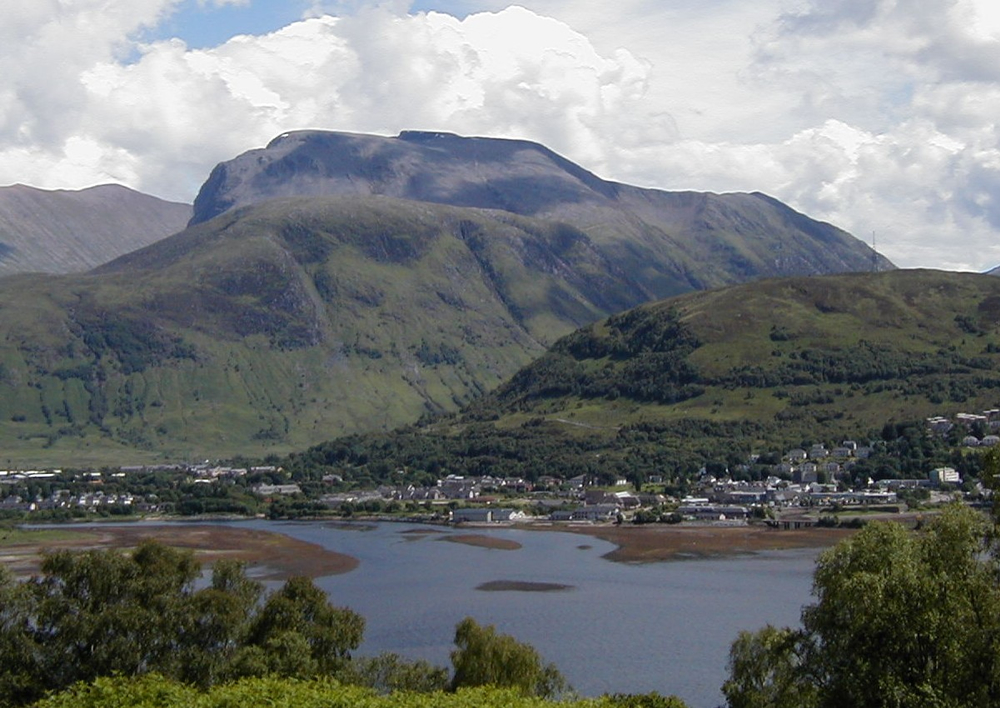
Britain’s highest peak, Ben Nevis, stretches up some 1,344 metres into the Scottish sky, putting it well clear of all others in Britain, occupying a rather remote area of the Scottish Highlands.
Snowdon
Wales’s largest mountain, Snowdon is the third highest in Britain, with a prominence of 1,038 metres.
The Pennines are home to three national parks, which are all fabulous tourist hotspots. These are the Yorkshire Dales, Northumberland, and the Peak District.
The Pennine Mountain Range plays an integral role as a water catchment area and, therefore, boasts serval reservoirs, including Kielder Water and Ladybower Reservoir. These are situated in the main valleys of the range. The abundance of water features, rocky crags and glorious greenery has made the Pennines some of the most awe-inspiring sights in the country.
Some parts of the range are characterised by exposed limestone, which has led to an extensive variation of caves and rivers due to its lower resistance against erosion. The caves are some of the biggest in all of England. The erosion of the limestone has also created impressive rock formations, delighting spectators.
The peaks of the Pennines are relatively low, often referred to as fells, rather than mountains. These include the fells of Mickle, Ingleborough, Whernside and High Seat. There are also various dales, such as Airedale, Dovedale, Ribblesdale and Wensleydale.
| 1 | Scafell Pike | t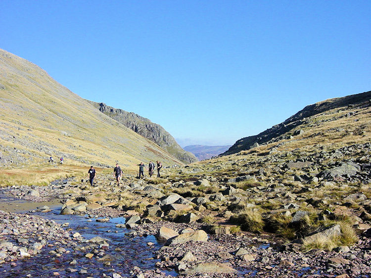 | |||
In the Lake District, 500 million years of geological processes have produced a physical landscape of mountains and lakes of great scenic beauty.
Slate developed from sediments in oceans and seas, volcanoes erupted, limestone was formed by the deposition of dead crustaceans and sandstone was created in desert conditions. Various minerals were also formed in joints and faults in the bedrock.
The layers of rock formed were shifted and sculpted - first through different stages of folding and uplifting and then by the actions of glaciers and meltwater.
As a result the topography of the Lake District includes smooth U-shaped valleys and steep and sharp ridges, England’s highest mountain and deepest and longest lakes. The Lake District is often compared to a wheel, with the hub approximately at Dunmail Raise, north of Grasmere. The valleys and lakes radiate outwards as the 'spokes'.
The Lake District has over fourteen lakes and tarns. The Lake District’s volcanic rock does not allow water to seep away. The high rainfall, combined with the extra deep glacial valleys, means that the valleys are able to store large volumes of water.The climate affects all areas of life in the Lake District. It helped create the landscape of fells, valleys and lakes. It influences farming and tourism and the local economy. It provides opportunities for a wide range of sport, leisure and business activities.
ì |
No comments:
Post a Comment