Total Pageviews

Friday, February 27, 2015

The wall street 20s collapse created hitler


After the Wall Street Crash, America gave Germany 90 days to start to re-pay money loaned to her. No other world power had the money to give Germany cash injections. Britain and France were still recovering from the First World War and the Wall Street Crash was to have an impact on industrial Britain. Stalin’s Russia was still in a desperate state and embarking on the 5 year plans. Therefore, an impoverished Weimar Germany could only call on America for help and she was effectively bankrupt by the end of 1929 and quite incapable of lending money.
Companies throughout Germany - though primarily in the industrial zones such as the Ruhr - went bankrupt and workers were laid off in their millions. Unemployment affected nearly every German family just 6 years after the last major economic disaster - hyperinflation - had hit Weimar.The Weimar Republic was devastated by Wall Street Crash of October 1929 and the Great Depression that followed. The Crash had a devastating impact on the American economy but because America had propped up the Weimar Republic with huge loans in 1924 (the Dawes Plan) and in 1929 (the Young Plan), what happened to the American economy had to impact the Weimar Republic's economy.

Both plans had loaned Weimar money to prop up the country’s economy - especially after the experiences of hyperinflation in 1923. Now America needed those loans back to assist her faltering economy.
Gustav Stresemann was born in 1878 and died in 1929. Stresemann took Weimar Germany out of its darkest hour – hyperinflation – to the so-called ‘Golden Years of Weimar’. He died just before the event that was to have a terminal impact on the Weimar Republic – the Wall Street Crash of 1929.
Stresemann was born in Berlin. In 1906, at the age of 28, he became a Reichstag deputy and he was elected the leader of the National Liberal Party in 1917. He later re-named this party the Peoples’ Party in 1919.
Stresemann had died in 1929, but shortly before he died even he admitted that the German economy was a lot more fragile than some would have liked to accept.     In the 1920s, there was a rapid growth in bank credit and loans. Encouraged by the strength of the economy people felt the stock market was a one way bet. Some consumers borrowed to buy shares. Firms took out more loans for expansion. Because people became highly indebted, it meant they became more susceptible to a change in confidence. When that change of confidence came in 1929, those who had borrowed were particularly exposed and joined the rush to sell shares and try and redeem their debts.
Buying on the MarginRelated to buying on credit was the practise of buying shares on the margin. This meant you only had to pay 10 or 20% of the value of the shares; it meant you were borrowing 80-90% of the value of the shares. This enabled more money to be put into shares, increasing their value. It is said there were many ‘margin millionaire’ investors. They had made huge profits by buying on the margin and watching share prices rise. But, it left investors very exposed when prices fell. These margin millionaires got wiped out when the stock market fall came. It also affected those banks and investors who had lent money to those buying on the margin.
A lot of the Stock Market crash can be blamed on over exuberance and false expectations. In the years leading up to 1929, the stock market offered the potential for making huge gains in wealth. It was the new gold rush. People bought shares with the expectations of making more money. As share prices rose, people started to borrow money to invest in the stock market. The market got caught up in a speculative bubble. – Shares kept rising and people felt they would continue to do so. The problem was that stock prices became divorced from the real potential earnings of the share prices. Prices were not being driven by economic fundamentals but the optimism / exuberance of investors. The average earning per share rose by 400% between 1923 and 1929. Yet, those who questioned the value of shares were often labelled doom-mongers.

This was not the first investment bubble, nor was it the last. Most recently we saw a similar phenomena in the dot com bubble.
In March 1929, the stock market saw its first major reverse, but this mini-panic was overcome leading to a strong rebound in the summer of 1929. By October 1929, shares were grossly overvalued. When some companies posted disappointing results on October 24 (Black Thursday), some investors started to feel this would be a good time to cash in on their profits; share prices began to fall and panic selling caused prices to fall sharply. Financiers, such as JP Morgan tried to restore confidence by buying shares to prop up prices. But, this failed to alter the rapid change in market sentiment.  On October 29(Black Tuesday) share prices fell by $40 billion in a single day. By 1930 the value of shares had fallen by 90%. The bull market had been replaced by a bear market.

Mismatch between production and consumption
The 1920s saw great strides in production techniques, especially in industries like automobiles. The production line enable economies of scale and great increases in production. However, demand for buying expensive cars and consumer goods were struggling to keep up. Therefore, towards the end of the 1920s many firms were struggling to sell all their production. This caused some of the disappointing profit results which precipitated falls in share prices.


Thursday, February 26, 2015

THE LANDSCAPE OF THE UK

England covers over 50,000 square miles (130 439 square kilometres) and is the largest of the countries comprising the island of Britain, covering about two-thirds of the island. No place in England is more than 75 miles (120 km) from the sea.

The landscape is determined mainly by the different types of rock underlying it. In the south, chalk has produced the gently rolling hills of the Downs, while hard granite is the basis for the mountains of the north and the high moorlands of Dartmoor and Exmoor in the south-west.
Much of the land in England is flat (low lying) - less than 1000m above sea level, forming meadowlands and pastures and less than 10 percent of the area is covered by woodlands.

 Farmers raise animals or grow crops in the fields.

Weather and climate - what’s the difference?
It is important to understand the difference between weather and climate. Both refer to what happens in the atmosphere.
  • Weather is the condition of the atmosphere over a short period of time - what happens day to day
  • Climate is the average expected weather over the seasons for a region - the long term pattern
To put it another way:
climate is what you expect; weather is what you get!


Upland areas are generally confined to northern England: the exceptions are the upland moors of Dartmoor and Exmoor in the south-west.
he landscape of England is more rugged in the north and the west. The highest elevations are in Cumbria


The Southwest
 is a long peninsular with bleak moorlands and rocky outcrop. The wide expanse of Salisbury Plain .The southeast corner, from Dover to Eastbourne, has dramatic chalk cliffs bordering the English channel.


Rivers
occupies most of the central part of southern England.
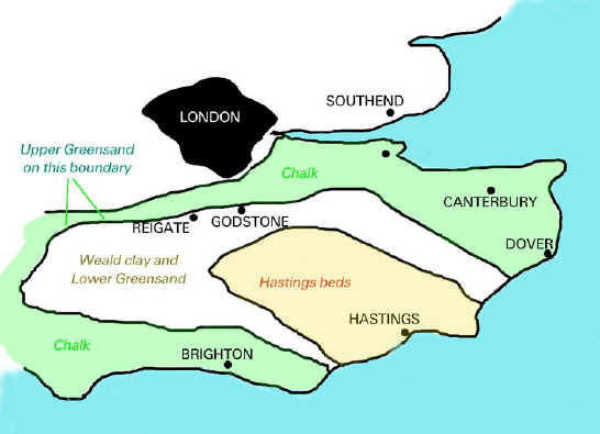
In the Southeast, a horseshoe-shaped ring of chalk downs surrounds the formerly wooded area of the


England's best known river is, of course, the Thames which flows through London. It is also the longest, at 346km, in England.The River Severn is the longest in total, but its source is in the mountains of Wales, and the parts which run through England are shorter than the Thames.

 
Coastline
England has a long coastline of 3,200 km. In the south and west, the coastline can be rocky, with steep cliffs. The east coast is often flat and low lying, with beaches and mud flats.

 
The Borders of England.

The English Channel runs along England's southern border, and the North Sea forms England's eastern border. Wales and the Irish Sea border England to the West. Scotland runs along England's northwestern borders
.

 
The Cheviot Hills are a range of low mountains forming a border between England and Scotland. They extend 35 miles ( 56 km) is a north-eastern to south-western direction. The hills are part of the Northumberland National Park.


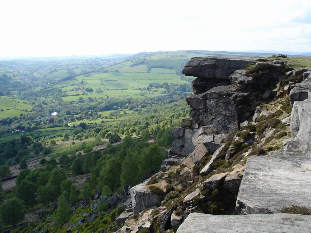
The Peak District lies in the southern part of the Pennines. It contains England's first national park, which was established in 1951 . The Peak District covers and area of about 555 sq miles (1,438 sq km). The northern region of the Peak District is covered in moors and oddly shaped hills. The central and southern regions have rolling hills and green valleys.

 
The North Yorkshire Dales lie east of the Pennines. This national park stretches across 500 square miles (1,295 square kilometers), touching the North Sea. In the south is the Yorkshire moors consisting of low hills covered with coarse marsh grasses and low evergreen shrubs of heather.


The wide expanse of Salisbury Plain occupies most of the central part of southern England. It covers an area of approximately 300 square miles ( 775 sq km) and is drained to the south by the River Avon. Sailsbury plain is a barren chalk plateau without trees and much of it is used as a pasture for sheep.
Many people travel to see Stonehenge, a prehistoric monument located on Salisbury Plain.

The Downs are a series of rolling chalk hills found in southern England.
The Seven Sisters are chalk cliffs, part of the coastline of the south-eastern tip of England.

Seven Sisters (chalk cliffs)
Dartmoor moorland area is famous for the wild Dartmoor ponies that live there.


While England is a relatively flat country, it certainly is not devoid of impressive mountains and many rolling hill plains.
 These create a gorgeous topography and a natural allure to the jade-coloured countryside of this land.
 Britain is certainly blessed with an enviable pedigree of mountains. Whether it’s the iconic Ben Nevis or majestic Snowdon, England’s Scafell Pike or the rolling Pennines, there’s plenty to behold – and to climb.


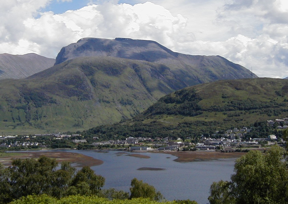
Ben Nevis
Britain’s highest peak, Ben Nevis, stretches up some 1,344 metres into the Scottish sky, putting it well clear of all others in Britain, occupying a rather remote area of the Scottish Highlands.
 
 
Snowdon
Wales’s largest mountain, Snowdon is the third highest in Britain, with a prominence of 1,038 metres.

The Pennines are home to three national parks, which are all fabulous tourist hotspots. These are the Yorkshire Dales, Northumberland, and the Peak District.

The Pennine Mountain Range plays an integral role as a water catchment area and, therefore, boasts serval reservoirs, including Kielder Water and Ladybower Reservoir. These are situated in the main valleys of the range. The abundance of water features, rocky crags and glorious greenery has made the Pennines some of the most awe-inspiring sights in the country. 

Some parts of the range are characterised by exposed limestone, which has led to an extensive variation of caves and rivers due to its lower resistance against erosion. The caves are some of the biggest in all of England. The erosion of the limestone has also created impressive rock formations, delighting spectators.
The peaks of the Pennines are relatively low, often referred to as fells, rather than mountains. These include the fells of Mickle, Ingleborough, Whernside and High Seat. There are also various dales, such as Airedale, Dovedale, Ribblesdale and Wensleydale. 


1Scafell PiketStyhead Pass


In the Lake District, 500 million years of geological processes have produced a physical landscape of mountains and lakes of great scenic beauty.

Slate developed from sediments in oceans and seas, volcanoes erupted, limestone was formed by the deposition of dead crustaceans and sandstone was created in desert conditions. Various minerals were also formed in joints and faults in the bedrock.
The layers of rock formed were shifted and sculpted - first through different stages of folding and uplifting and then by the actions of glaciers and meltwater.
As a result the topography of the Lake District includes smooth U-shaped valleys and steep and sharp ridges, England’s highest mountain and deepest and longest lakes. The Lake District is often compared to a wheel, with the hub approximately at Dunmail Raise, north of Grasmere. The valleys and lakes radiate outwards as the 'spokes'.


The Lake District has over fourteen lakes and tarns. The Lake District’s volcanic rock does not allow water to seep away. The high rainfall, combined with the extra deep glacial valleys, means that the valleys are able to store large volumes of water.The climate affects all areas of life in the Lake District. It helped create the landscape of fells, valleys and lakes. It influences farming and tourism and the local economy. It provides opportunities for a wide range of sport, leisure and business activities.

ì